The Desk Study for the Graney Demonstration Catchment in on the borders of Counties Clare and Galway has been published.
The Desk Study was prepared by Local Authority Waters Programme (LAWPRO) catchment scientists on behalf of the Waters of LIFE Project.
Desk Studies are the first stage in Project Action C1: Catchment Walkover Investigations. They are the initial investigations of the catchments based on a range of available data sources.
These include OSi mapping and orthophotography, EPA status, risk assessment and pressure datasets, CORINE land cover mapping, Forest Service and Coillte data on forest activities and Geological Survey of Ireland (GSI) data on Soils and geology.
These data are collated into one report detailing the current conditions within the catchments, and listing any potential pressures and threats to water quality within them.
This is the sixth and final Desk Study published by the project.
The Desk Study for the Islands Demonstration Catchment in on the borders of Counties Roscommon and Galway has been published.
The Desk Study was prepared by Local Authority Waters Programme (LAWPRO) catchment scientists on behalf of the Waters of LIFE Project.
Desk Studies are the first stage in Project Action C1: Catchment Walkover Investigations.
They are the initial investigations of the catchments based on a range of available data sources.
These include OSi mapping and orthophotography, EPA status, risk assessment and pressure datasets, CORINE land cover mapping, Forest Service and Coillte data on forest activities and Geological Survey of Ireland (GSI) data on Soils and geology.
These data are collated into one report detailing the current conditions within the catchments, and listing any potential pressures and threats to water quality within them.This is the fifth Desk Study published by the project.
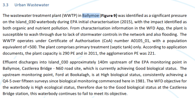
LAWPRO has drafted a referral to Irish Water outlining the concerns above. Under Irish Water’s River Basin Management Plan Enhanced Ambition Programme, Ballymoe WWTP will be upgraded, with the upgrades due to be completed by 2025.
Carry out a hydromorphological assessment on the waterbodies within the Islands Demonstration catchment in order to understand current condition and the hydromorphological issues driving that condition, and to identify appropriate river restoration measures to mitigate those issues, considering multiple benefits.
The assessment should be based on a combination of desk based studies and targeted field investigations. Reference should be made to the output LAWPRO local catchment assessments
The successful tenderer will be required to carry out a hydromorphological assessment on the waterbodies within the Islands Demonstration catchment in order to understand current condition and the hydromorphological issues driving that condition, and to identify appropriate river restoration measures to mitigate those issues, considering multiple benefits. The assessment should be based on a combination of desk based studies and targeted field investigations. Reference should be made to the output LAWPRO local catchment assessments.
Relevant stakeholders should be consulted and environmental screening of proposed measures should be provided as required (EcIA, AA and NIS).
A comprehensive outline of the methodologies to be employed and the data sources to be consulted should be submitted along with a proposed timetable for completion of the various stage of the project (it is expected that the final report should be delivered within 3 months of the date of appointment).
The project deliverables will be: – Final Hydromorphological Assessment Report and River Restoration Plan – Relevant shapefiles, raw data and photographs
Desk Studies are the first stage in Project Action C1: Catchment Walkover Investigations. They are the initial investigations of the catchments based on a range of available data sources.
These include OSi mapping and orthophotography, EPA status, risk assessment and pressure datasets, CORINE land cover mapping, Forest Service and Coillte data on forest activities and Geological Survey of Ireland (GSI) data on Soils and geology. These data are collated into one report detailing the current conditions within the catchments, and listing any potential pressures and threats to water quality within them.
This is the first Desk Study published by the project.
Research is needed to design and implement a suitable monitoring programme that has the capacity to assess the status of high-status objective river water bodies, the environmental stressors that are preventing high status from being achieved, and the effectiveness of measures put in place to protect and maintain the status of these waters.
Innovative research proposals are therefore invited to:
• Undertake a detailed literature review of the most appropriate quality elements, metrics, methods and frequencies to be included in a monitoring programme of high-status objective river water bodies.
• Design a suitable multi-year monitoring programme that is sufficiently representative of the different types and magnitude of environmental stressors, pressures and water body types in each demonstration catchment.
• Implement the monitoring programme in the six demonstration catchments during the lifetime of the project.
• Establish a baseline and a suitable number of control sites against which improvements in environmental conditions can be assessed and quantified in each of the demonstration catchments during the lifetime of the monitoring programme.
• Develop a set of Key Performance Indicators based on the information collected by the programme to be used to track the effectiveness of measures in protecting or improving the condition of high-status objective water bodies during the lifetime of the project.