CANN Peatland Project

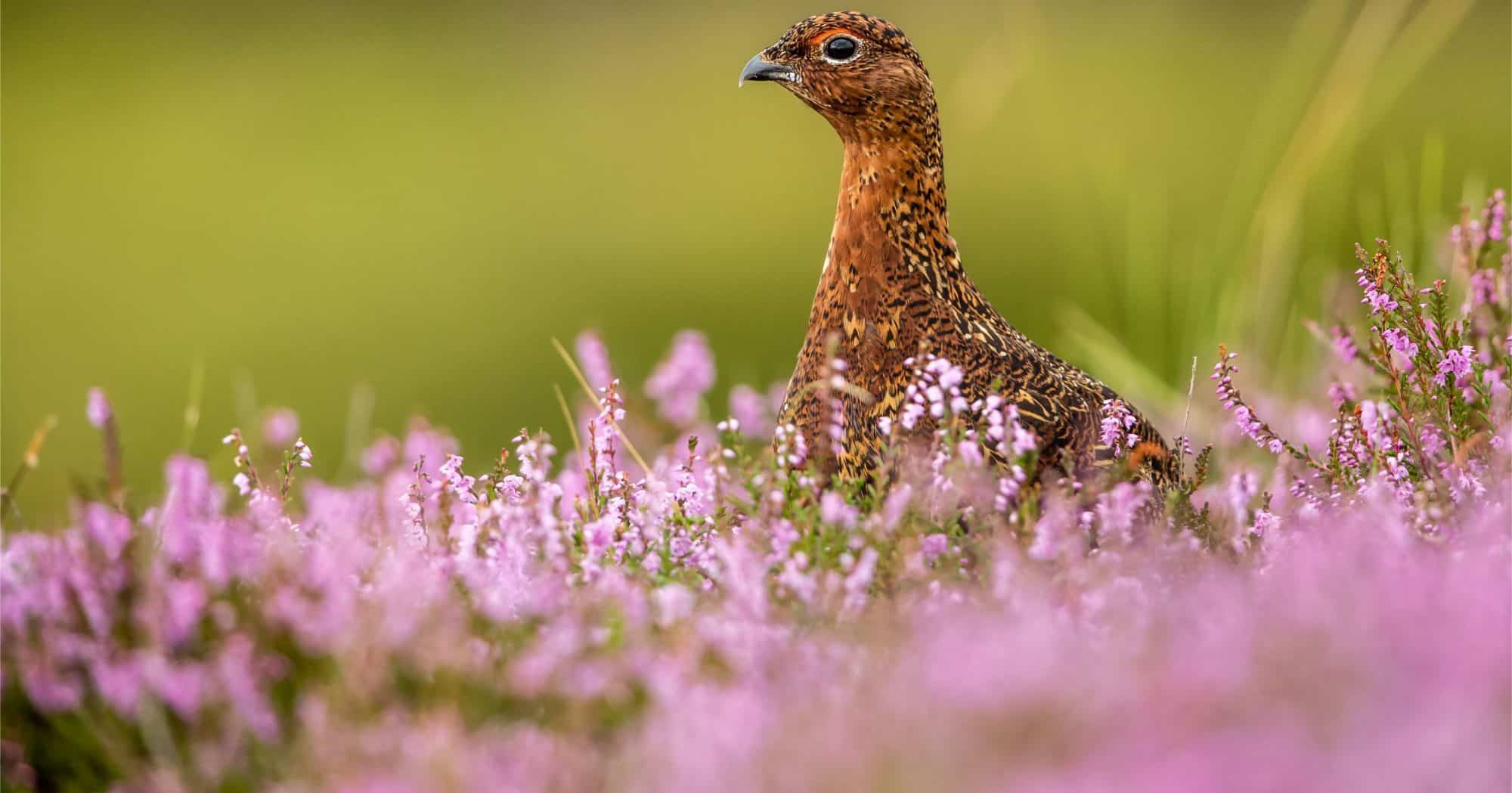
The CANN project is a cross-border environment project which aims to improve the condition of protected habitats and to support priority species found within Northern Ireland, the Border Region of Ireland and Scotland, allowing the region to meet key EU biodiversity targets and ensuring the future of these internationally important habitats and species.

With €9.4 million of funding from the INTERREG VA programme the CANN project team will produce Conservation Action Plans for a range of sites across the jurisdictions which are designated as Special Areas of Conservation (SACs) and accumulatively account for over 25,000 hectares of land.

Direct conservation actions will be carried out on 3,650 hectares of these SACs, all with an aim to help and guide the habitats and species found at these sites towards a favourable conservation status.

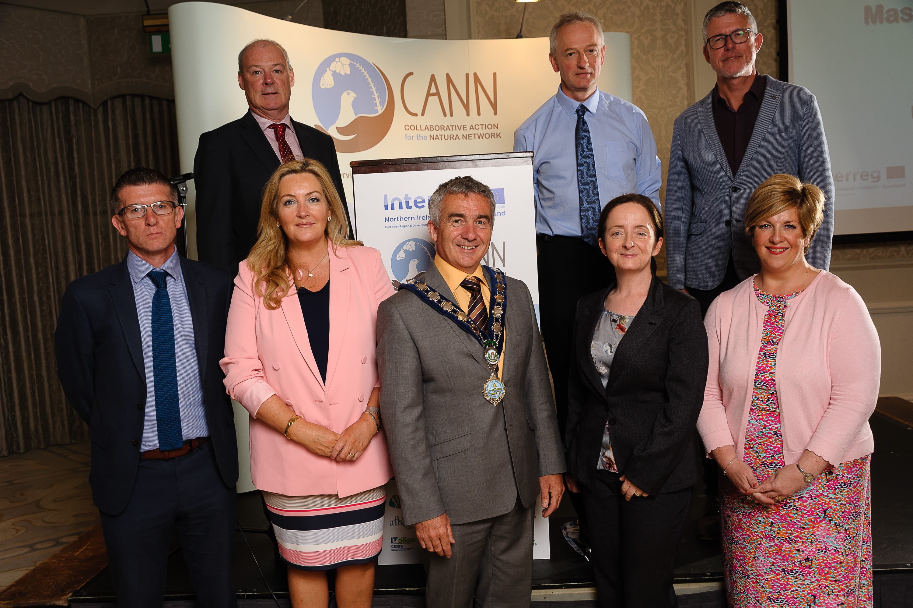
Made up of leading government departments, local authorities, research institutions and charities from across the three jurisdictions, the CANN project team will work together with local communities and stakeholders towards a common goal of improving the environmental condition of these SACs.  

This includes delivering educational and outreach programmes and raising awareness of the significance of the habitats and species found on the sites, with the aspiration of safeguarding the conservation of these key sites and ensuring their sustainability beyond 2021 and the lifespan of the CANN project.

The CANN project aims to improve the condition of protected blanket bog and key wetland habitats and to support the priority species found there through:

  • Carrying out on the ground conservation actions on over 3,650ha of designated sites (Special Areas of Conservation) to improve their environmental condition;
  • Producing 27 Conservation Action Plans (CAPs) which will act as a roadmap to recovery for these sites and inform strategic planning processes to ensure that these sites continue to be guided towards favourable conservation status beyond the lifespan of the CANN project;
  • Operating as a multi-jurisdictional network to exchange conservation knowledge and environmental best practice, to strengthen cross-border co-operation in facilitating the recovery of these protected habitats and priority species, and to ensure that borders do not represent an overwhelming barrier for conservation and biodiversity;
  • Working with stakeholders, landowners and local communities to bring about positive environmental change, and to raise awareness of the value of these habitats and species and the importance of conserving them.

The progress The CANN Project has made to date:

  • May 2017: The CANN project receives permission to start work, and partner organisations sign the CANN partnership agreement.
  • Summer 2017 to date: Stakeholder engagement commenced during summer 2017 and has been on-going ever since.
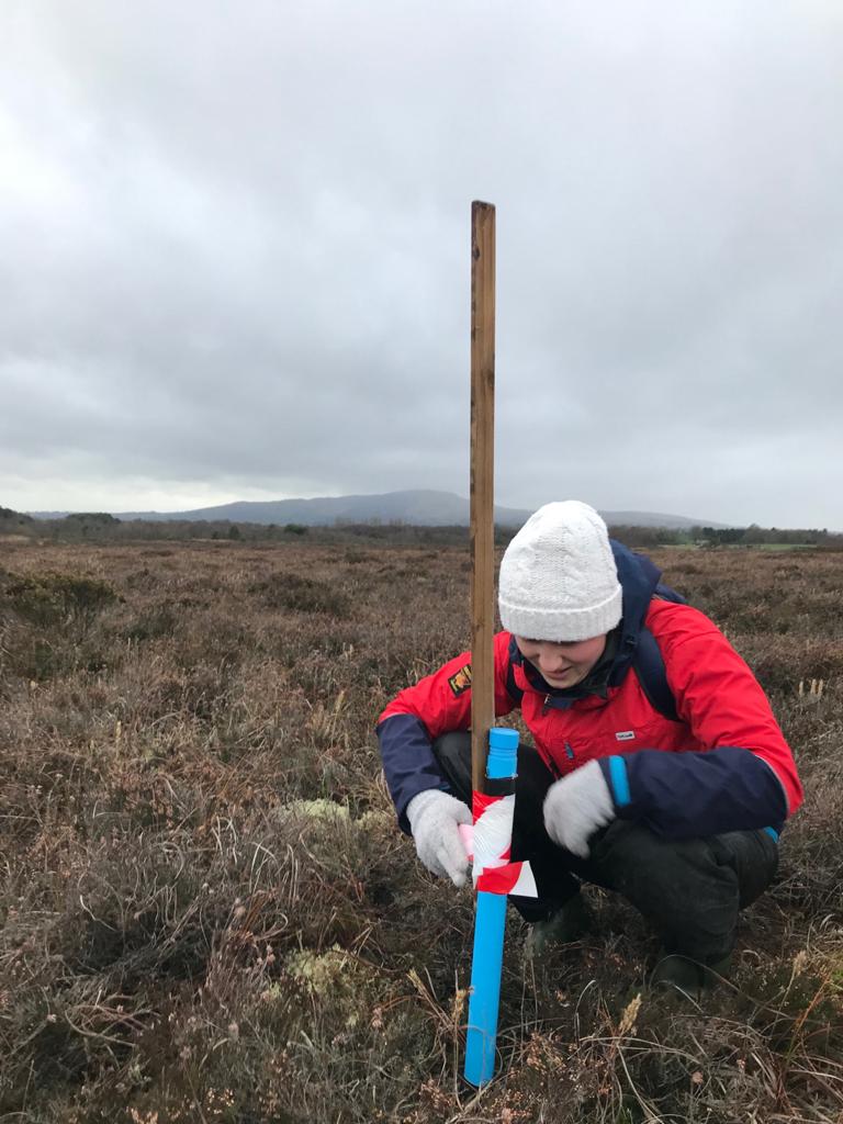
  • Spring – Summer 2017: Work begins on establishing an accurate baseline assessment of habitats and species across the project sites through fieldwork, surveys, and digital mapping.
  • Autumn – Winter 2017: Liaison between the CANN project and government departments and agencies across the three jurisdictions increases as a template for the Conservation Action Plans is drafted, and agreements are made to facilitate the sharing of best practice, data and knowledge.
  • May 2018: A standard Conservation Action Plan (CAP) template is agreed with the relevant government departments and agencies.
  • June 2018: The CANN project holds a successful launch event in Co. Monaghan with Ella McSweeney, a renowned Irish Journalist and Environmentalist, delivering the key-note address.
  • Spring-Summer 2018: Baseline surveying is carried out across most project sites. This includes bird and nest location surveys, collection of bathymetry and water quality data, habitat quality assessments, and invasive species studies.
  • Spring -Summer 2018: Implementation of on the ground actions begins based on the data collected during baseline surveying in spring-summer 2017 and early 2018, namely nest protection and rhododendron control. The success of these on the ground actions will be carefully monitored year on year.
  • July 2018: The CANN project receives additional funding of €1.1million for Cuilcagh.
  • August 2018: An invasive species management trial takes place at Lough Arrow, Co. Sligo, and will be closely monitored for success. Read more about this trial and why it is needed here.
  • September 2018: The very rare Desmoulin’s whorl snail is found on a CANN project site in Co. Down – the first time this species has ever been found in Northern Ireland. Read more about how important a find this is here.
  • September 2018: CANN project staff carry out Sphagnum moss restoration trials on areas of degraded bog at Peatlands Park. These trials will be carefully monitored to see if they can be replicated across project sites. Read more about this revolutionary method here.
  • Summer 2018: workshops on best practice in writing conservation management plans, and peatland restoration techniques held on Islay. Biosecurity workshop held in Magheraveely/ Kilroosky and an International Bog Day celebration held on Cuilcagh.
  • Summer 2018: CANN showcased at various conferences including IUCN 2019 conference and UKILN (the UK and Ireland Lakes Network)
  • November 2018: Biosecurity training takes place with stakeholders of Lough Arrow in Co. Sligo. Read more about the training and why it is important here.
  • September 2018: CANN project staff carry out Sphagnum moss restoration trials on areas of degraded bog at Peatlands Park. These trials will be carefully monitored to see if they can be replicated across project sites. Read more about this revolutionary method here.
  • December 2018: Ten draft Conservation Action Plans are produced.
  • January 2019: draft plans for Eilean na Muice Duibhe and The Rinns  produced, work continues all year with ongoing monitoring and stakeholder engagement to produce final plans
  • January 2019: Four draft plans submitted for Ballynahone Bog, Garry Bog, Tully bog and Turmennan
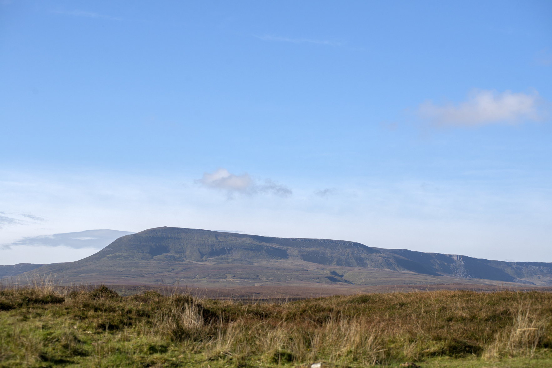
  • Spring/ Summer 2019: fieldwork and mapping projects are undertaken on Ben Nevis and many other Scottish sites
  • September 2019: Successful Mid Term Conference held. Read more about the conference here.
  • September 2019: Rhododendron control contracts were completed at Tully, Fairywater and Ballynahone bog
  • October 2019: CANN gave a presentation at the Burren Winterage event
  • October 2019: a complete habitat map of Sliabh Beagh site is produced including conifer mapping and landowner, turbary rights and bird data from Golden Eagle Trust
  • November 2019: CANN representatives attended the England and Wales Wildfire Forum Conference in Cardiff, on the theme of “Manage the fuel, reduce the risk.”
  • December 2019: Chainsaw course provided for landowners on Colonsay. This led to positive engagement and gave landowners the skills needed to remove rhododendron on their own land on the island through Single Tender Actions.
  • December 2019: a draft Conservation Action Plan was submitted for Moneygall Bog. A draft Habitat plan was completed for Magheraveeley, and Kilrooskey and habitat maps were completed for the 7 SACs on the Scottish mainland that are included in the CANN project.
  • January 2020: work on Wildfire Management plan for Cuilcagh mountain commenced in partnership with Pau Costa from Spain.
  • January 2020: CANN members attended the England and Wales Wildfire Forum Conference in Cardiff on the theme of  “Reduce the fuel, reduce the risk.”
  • January 2020: Ammonia monitoring is started on Cuilcagh Mountain as part of a cross border investigation into deposition of this airborne chemical. Peatland park and other bogs are also going to have monitors fitted. Water level monitoring continues.
  • January 2020: RPS completes its restoration plans for Cuilcagh Mountain and water monitoring loggers are installed
  • January 2020: CANN is represented by Ulster Wildlife, Monaghan County Council and Armagh and Banbridge council at the Conference of the British Ecological Society.
  • January and February 2020: winter tranche of filming for the CANN video starts with ASG video filming at Moneygall and Cranny bogs to see drain blocking in action (see a short youtube video here) and at Peatlands Park to record vegetation clearance.
  • February 2020: a draft Habitat map was completed for Kilroosky/Magheraveeley lake cluster. Habitat maps were also completed for all the CANN sites on the Scottish Mainland which will be added to existing draft Conservation Action Plans completed in 2019.
  • February 2020: Tree planting of native species took place on Duich Moss on Colonsay to replace the shelter provided by the rhododendron that has been removed.
  • February 2020: 12 Ha of conifers and birch are removed from Moneygall bog. These trees were sucking the bog dry, and their removal means we can start the re-wetting process.
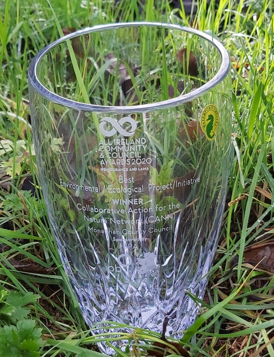
  • February 2020: CANN project received the award for the best environmental/ecological project at the All Ireland Community and Council Awards 2020
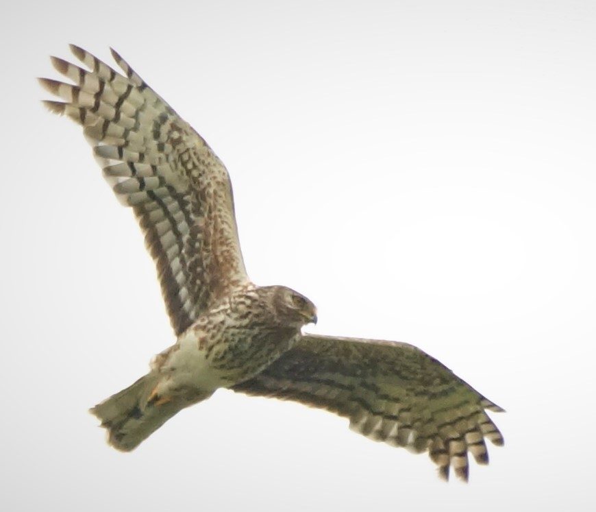
  • March 2020: winter bird recording season comes to an end, with wintering golden plover, snipe, hen harriers and red grouse all recorded. An outstanding year for long-eared owls across many sites.
  • March 2020: Radon testing carried out to discover the source of water on Kilrooskey/Magheraveeley. CANN staff are trained in molecular biology techniques to use eDNA in detecting populations of crayfish in the lakes.

March 2020: Drain blocking is completed at Cranny Bogs.

  • March 2020: the habitat map for Sliabh Beagh is completed and work in underway for maps for another 8 raised bogs.
  • March 2020: Covid 19 strikes, meaning that the spring bird surveys cannot be undertaken; this will leave a hole in our data and have an ongoing effect on our planning. Much fieldwork is postponed, but work on CAPs proceeds apace.
  • April 2020: a vast swathe of Sliabh Beagh is given to a new landowner, An Taisce the National Trust for Ireland. This will make CANN’s task much easier in this SAC as the aims of An Taisce closely align with those of CANN.
  • April 2020: tender issued for first interpretation project at Lough Arrow. Information gathering for the All-CANN site interpretation project started.
  • May 2020: CANN goes online organising Seminars and workshops for partners and stakeholders over the summer, so training and outreach continue while people are unable to travel.
  • May 2020: plans progress for the removal of the alien invasive plant Japanese Knotweed at Drumnafallow and Lecale Fens. A second tender is issued for the removal of Rhododendron and drain-blocking at Fairywater and Peatlands Park.
  • May 2020: Lidar is flown on Cuilcagh to map peat depths, drains and to help in wildfire modelling
  • May/June 2020: making the most of a mountain empty of tourists, vegetation restoration was carried out on the summit of Cuilcagh Mountain. Social distancing was strictly adhered to.
  • May/June 2020: as lockdown eases, staff and volunteers from The Golden Eagle Trust carried out the first round on breeding bird surveys in record time to attempt to catch up on the lost months of data. Summer tranche of filming also takes place on Cuilcagh, Lough Arrow and Sliabh Beagh.
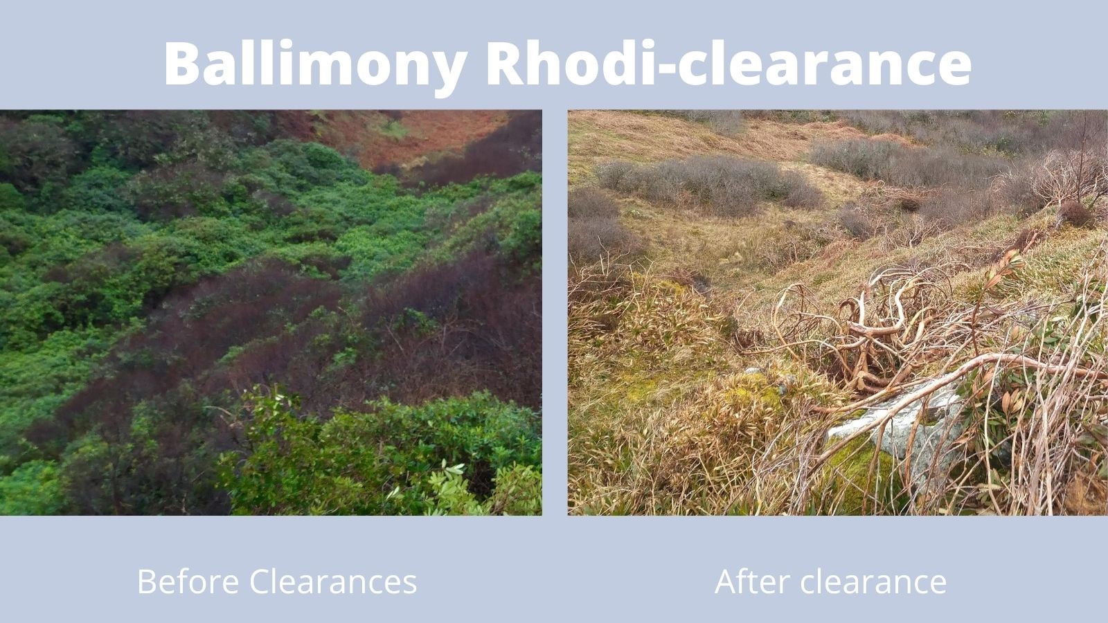
  • June 2020: Draft Conservation Action Plans completed for Cranny and Curran Bogs. before and after Rhododendron clearance at Ballimony
  • June 2020: the CANN project installs fencing to allow the grazing of uplands of Sliabh Beagh by the traditional breed of Dexter Cattle.
  • June 2020: Rhododendron clearance is completed on Ballimony estate (following bird surveys to ensure no disturbance of breeding birds) and a
    a contract is issued to complete the journey to Rhodi-free status of Colonsay Island.
  • June 2020: Drain blocking is complete on Tully Bog
  • June/July 2020: nest protection measures continue on Sliabh Beagh, sadly recreation and turf cutting pressures have caused problems for hen harriers and ground-nesting birds.
  • July/August 2020: Bird monitoring continued on Sliabh Beagh, Cuilcagh, lowland raised bogs by Golden Eagle Trust and on Islay by Islay Natural History Trust. Low numbers of Red Grouse were seen due to disturbance and poor weather, but 6 – 9 pairs of hen harriers bred on Sliabh Beagh. Seven wader species bred on Islay, hen harriers, bred on 4 sites, and Red Throat divers bred at Eilean an Muice Duibhe.
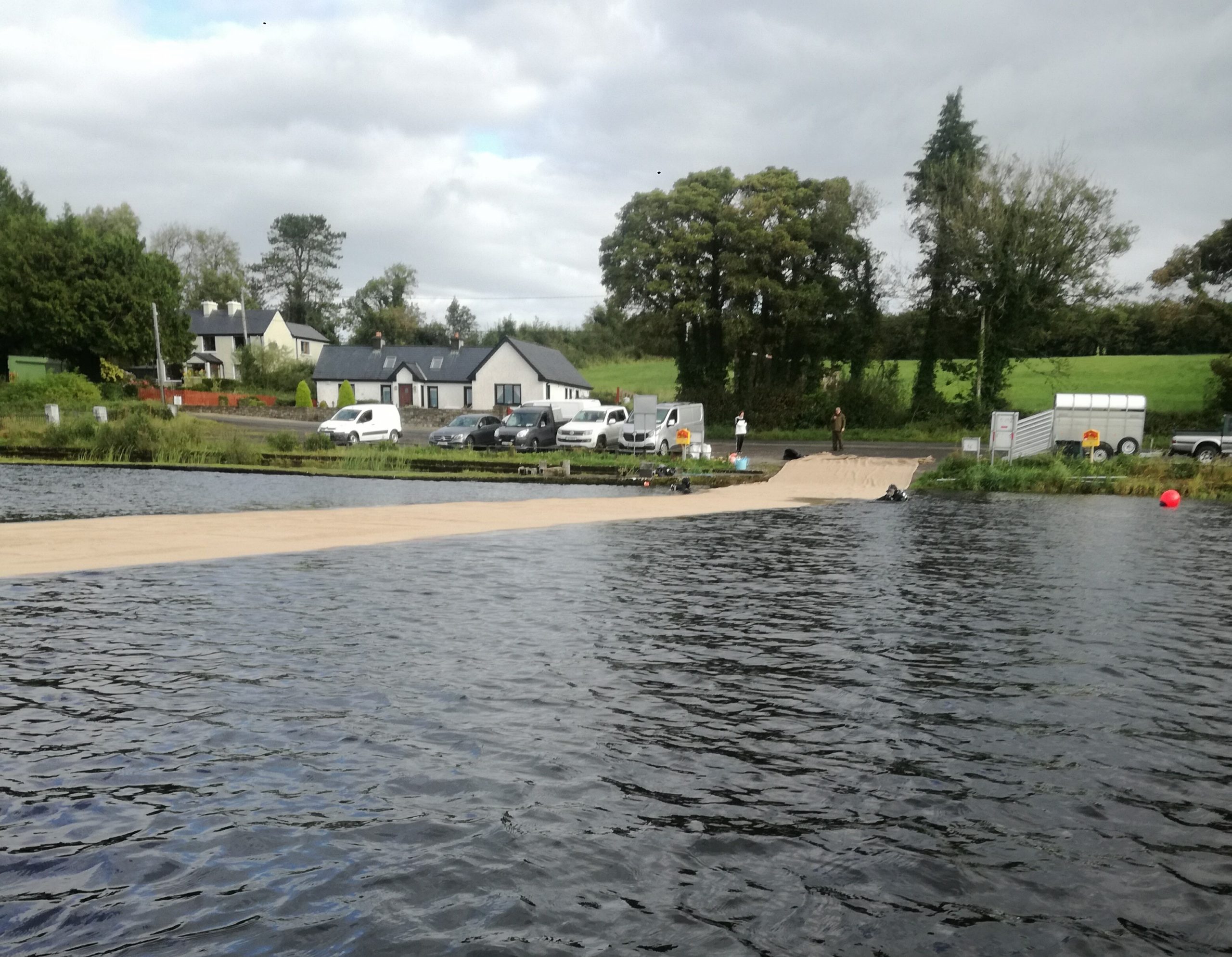
  • Jute laying at Lough Arrow August 2020: 1600square metres of jute matting was laid over invasive alien Elodea nuttali weed, native stone worst will grow through, but this matting will provide a weed-free corridor for boats which will be marked by buoys.
  • September 2020: Nineteen Conservation Action Plans (CAPs) have now been submitted to the relevant national governments. We are working on a further 8.
  • September 2020: The first year of follow up spraying was carried out on Duich and Ballinmony.
  • September 2020: A Drain blocking tender was advertised for drain blocking on Sliabh Beagh and work was undertaken to install plastic dams at Peatland Park and Fairywater and more peat dams on Moneygall.
  • September/October 2020: Filming continues on Turmenan and Islay and at Kilrooskey Lakes.

CABB Peatland Project

Co-operation Across Borders for Biodiversity (CABB)

Supported by the European Union’s INTERREG VA Programme, managed by the Special EU Programmes Body (SEUPB), CABB is a €4.9m five-year partnership project. It is led by RSPB NI and also involves RSPB Scotland, Birdwatch Ireland, Butterfly Conservation, Moors for the Future and Northern Ireland Water.

Project will produce Conservation Action Plans (CAPs) for eight SACs/SPAs in Northern Ireland, the Republic of Ireland and Scotland.

The sites where CAPs will be prepared are as follows:


The CABB team will also conduct habitat management work at key sites, including blocking drains to re-wet blanket bogs, introducing predator fences and new grazing regimes on blanket bog and machair, managing rush on lowland wet grassland, and consolidating the sea wall at Loch Gruinart, Islay, to protect the habitat beyond for breeding waders and wintering wildfowl. 

CABB is a three-country, six-partner conservation project that will improve habitats for birds, butterflies and plants across Northern Ireland, Ireland and the west coast of Scotland.

Four peatland SACs in Co Donegal selected for Conservation Plans, drawn up in consultation and with participation of landowners, farmers and other stake-holders such as foresters, local and state authorities, turbary owners and turf-cutters, water utilities, tourism operators and so on.

The CABB sites contain some of the best remaining expanses of lowland and upland active blanket bog, where notable, distinctive features are the mossy hummocks interspaced with wet hollows or Atlantic Bog Pools, Fens and flushes, Transition Mires and Quaking Bog, each hosting specialist flora and fauna that collectively makes up a treasure trove of Ireland’s ecology and biodiversity.

These plans will propose a package of steps, measures and actions aimed at accomplishing effective conservation and restoration of the EU Priority Habitat, Blanket Bog, as well as associated habitats and birds, especially Annex 1 or red-listed species including breeding Golden Plover, Dunlin, Red Grouse, and wintering Greenland-White-fronted Goose.

Objectives

  • Improve habitats for breeding wading birds such as curlews, lapwings, redshanks and snipe as well as hen harriers and marsh fritillary butterflies.
  • Work towards the restoration of 2,228 hectares (ha) of blanket bog across Northern Ireland, Scotland and Ireland.
  • Work closely with landowners and farmers to map habitats and prepare eight Conservation Action Plans (CAPs) for EU-designated sites (Special Areas of Conservation and Special Protection Areas).
  • Raise awareness in local communities of the environmental, cultural and historic importance of blanket bogs and key wetland habitats.
  • Share experiences, best practice and data.

Progress

  • Habitat improvement works at key wetland sites, including:
    • CABB funded fencing at Montiaghs Moss in Co Antrim, Airds Moss in Scotland and Pettigo National Nature Reserve in Co Donegal is facilitating much needed conservation grazing.
    • Rush cutting, maintenance work to predator fencing and scrub clearance work have enhanced conditions for breeding waders at Lough Erne, Co Fermanagh.
    • New machinery has been purchased in Co Fermanagh to aid in our conservation grazing efforts and management of wetland sites. A new Cot was purchased to transport livestock to the Lough Erne Islands of Fermanagh for conservation grazing and a new tractor with custom Soucy tracks has been delivered to delicately undertake rush cutting on the bog sites.
    • Removal of scrub and rank vegetation on Inisheher Island, Co Leitrim is supporting breeding curlew.
  • Butterfly Conservation are leading a dedicated programme to help the marsh fritillary butterfly by:
    • Identifying existing and potential breeding sites.
    • Working closely with landowners to sensitively manage habitat.
    • Training volunteers to assist with habitat and larval web surveys. In Autumn 2018, 34 new volunteers took part in training to record and identify breeding sites.
  • Large scale peatland restoration works successfully carried out at three sites in Scotland and Northern Ireland:
    • Over 1000 peat, wooden and stone dams have been installed to block drains at the Garron Plateau Special Area of Conservation (SAC) in Co Antrim.
    • In East Ayrshire, the Shiel Farm ‘Plantation to Bog Restoration’ project has been completed, and the former bog is now wholly rewetted.
    • 800 hectares of valuable peatland is now in recovering condition following restoration works at Tardoes Farm, also in East Ayrshire.
  • Contractors have delivered detailed habitat and LiDAR mapping of CABB sites in Northern Ireland, Ireland and Scotland. Mapping enhances our understanding of the varying habitats within each site and informs the specific actions that need to be taken to improve the condition of the land and enhance opportunities for wildlife.
  • The Conservation Action Plan (CAP) for the Muirkirk and North Lowther Uplands Special Protection Area (SPA) has been signed off by Scottish Natural Heritage. This is the first of eight CAPs which will be delivered by CABB. 
  • CABB surveys for all sites have provided valuable, up to date records on vegetation distribution and species:
    • Three annual breeding wader surveys were carried out by BirdWatch Ireland across twenty key coastal and machair sites in counties Donegal and Sligo.
    • 177 new species records for Pettigoe Plateau, Co Fermanagh have been submitted to the Centre for Environmental Data and Recording (CEDaR) in Northern Ireland.
  • CABB project officers have continued to learn from each other, share-best practice and participate in collaborative initiatives with other projects, including:
    • Information sharing events with our sister project ‘Collaborative Action for the Natura Network’ (CANN).
    • Attendance at the 2018 (Loch Lomond) & 2019 (Belfast) IUCN Peatlands conference and networking events.
  • Public engagement activities to raise awareness and involve the wider community in CABB conservation efforts include:
    • Information events for landowners and local residents.
    • Production of CABB project newsletters, a special educational leaflet on the Marsh Fritillary and a short film of the Garron Plateau.
    • High profile coverage on radio and television, including the popular TV series ‘Chronicles of Erne’ (BBC NI) and ‘Lough Neagh’ (UTV).
  • Engaging volunteers in all aspects of CABB, from surveys, scrub removal and fence repairs in the field, to assisting with finance, media and administration in the office.

Planned Work

By the end of 2021 we aim to have:

  • Published eight Conservation Action Plans for key EU designated SACs and SPAs. 
  • Blocked drains on the Garron Plateau with a view to restoring 444ha of blanket bog.
  • Blocked drains on the Muirkirk Uplands to allow 435ha of blanket bog to start recovering. 
  • Improved the condition of 900ha of blanket bog on the Dunragh Loughs/Pettigo Plateau SAC by erecting fencing and improving grazing. 
  • Blocked drains at Finandarry in the Ox Mountains with a view to restoring 449ha of blanket bog.
  • Improved 151ha of habitat at the Montiaghs SAC through water level management, scrub clearance, grazing and the installation of fencing.
  • Improved public access to the Montiaghs SAC through provision of a boardwalk and signage.
  • Improved 252ha of wet grassland in Co Fermanagh for breeding waders.
  • Consolidated the sea wall at Loch Gruinart, Islay, to protect key areas for breeding and wintering birds.
  • Uploaded habitat and species data to the main data management sites in each of the three countries.
  • Delivered practical conservation action for the endangered Marsh Fritillary butterfly to help manage the habitats it needs through conservation grazing.

For more information about:

https://www.rspb.org.uk/our-work/conservation/projects/co-operation-across-borders-for-biodiversity-cabb/

https://birdwatchireland.ie/our-work/species-habitat-conservation/countryside-wetlands/cabb-conservation-plans/

Maps

Garron Plateau

Montiaghs Moss SAC

Pettigoe Plateau SAC

Dunragh/ Pettigo Plateau SAC

Meentygrannagh SAC

Croaghonagh Bog

Lough Nillan Bog SPA/Lough Nillan Bog (Carricktlieve) SAC

Overriding water table control on managed peatland greenhouse gas emissions

Global peatlands store more carbon than is naturally present in the atmosphere

However, many peatlands are under pressure from drainage-based agriculture, plantation development and fire, with the equivalent of around 3 per cent of all anthropogenic greenhouse gases emitted from drained peatland.

Efforts to curb such emissions are intensifying through the conservation of undrained peatlands and re-wetting of drained systems

Here we report eddy covariance data for carbon dioxide from 16 locations and static chamber measurements for methane from 41 locations in the UK and Ireland.

We combine these with published data from sites across all major peatland biomes.

We find that the mean annual effective water table depth (WTDe; that is, the average depth of the aerated peat layer) overrides all other ecosystem- and management-related controls on greenhouse gas fluxes.

We estimate that every 10 centimetres of reduction in WTDe could reduce the net warming impact of CO2 and CH4 emissions (100-year global warming potentials) by the equivalent of at least 3 tonnes of CO2 per hectare per year, until WTDe is less than 30 centimetres.

Raising water levels further would continue to have a net cooling effect until WTDe is within 10 centimetres of the surface.

Our results suggest that greenhouse gas emissions from peatlands drained for agriculture could be greatly reduced without necessarily halting their productive use.

Halving WTDe in all drained agricultural peatlands, for example, could reduce emissions by the equivalent of over 1 per cent of global anthropogenic emissions.

https://www.hutton.ac.uk/news/improved-management-farmed-peatlands-could-cut-500m-tonnes-co2

UCD Swamp Project

UCD SWAMP aims to investigate the pressures on Irish waters from drained peatlands and develop mitigation measures

“This project is funded under the EPA Research Programme 2014-2020. The EPA Research Programme is a Government of Ireland initiative funded by the Department of Communications, Climate Action and Environment.”

The primary objective of SWAMP is to develop an interdisciplinary approach to quantify the pressures on waters arising from drained/extracted peatlands and develop appropriate regulatory measures, sustainable land use management and innovative technologies to ensure the status of water bodies is protected, maintained or improved in line with the requirements of national and international environmental standards. The key objectives of the project are as follows:


• To improve our understanding of the hydrology, hydrogeology, water balances and nutrient exports from drained and extracted peatlands.


• To investigate the impacts and pressures on water quality (chemistry, aquatic biota and hydromorphology) arising from the drainage and mining of peatlands by identifying contaminants pressure zones and assessing the significance and extent of these environmental impacts vis-à-vis the Water Framework Directive and Flood Directive targets.


• To evaluate environmental protection measures in order to develop best practices guidelines by appraising and developing a) robust water purification methods and b) sustainable land-use management practices including restoration/rewetting and after-use of cutaway/cutover bogs.

https://www.ucd.ie/swamp/

ReformWater: Reducing the effects of peatland forest management to inland waters

Goal: The overarching aim of this study is to investigate less invasive practices to reduce the harmful effects of peatland forest management on inland waters under the increased demands for tree biomass and the threat of climate change.

https://www.researchgate.net/project/ReformWater-Reducing-the-effects-of-peatland-forest-management-to-inland-waters

http://@ReformWater_IE

https://www.peatlandsgathering.com/post/improving-water-from-managed-bogs-swamp-and-reform-water-projects

The Living Bog Project

The largest single raised bog restoration project ever undertaken in Ireland

12 of Ireland’s unique raised bog SAC’s in seven counties will be brought back to life between 2016 – 2021, with additional works being undertaken on a further two bogs.

Restoration work on these Natura 2000 sites will improve over 2,600 hectares of threatened raised bog habitat – the equivalent of over 7,000 Croke Parks and 18% of the national high bog area.

It is estimated there has been a 99% loss of the original area of actively growing raised bog in Ireland’s mnidlands. What little remains is in need of restoration and conservation.

Thanks to this five year project, which has been made possible by the EU LIFE Nature and Biodiversity Fund, together with assistance from the National Parks and Wildlife Service at the Department of Housing, Local Government and Heritage the Living Bog will again become a reality

Ardagullion Bog SAC

The Habitats of Cutover Raised Bog

Details on each project bog:

Ardagullion Bog Co. Longford

Carrowbehy / Caher Bog Co. Roscommon

Carrownagappul BogCo. Galway

Clara Bog Co. Offaly

Derrinea Bog Co. Roscommon

Ferbane Bog Co. Offaly

Garriskil Bog Co. Westmeath

Killyconny Bog Co. Cavan

Mongan Bog Co. Offaly

Moyclare Bog Co. Offaly

Raheenmore Bog Co. Offaly

Sharavogue Bog Co. Offaly

Also see:

Irish Peatland Map 2009

Most recent national peatland map

GIS files were available on the EPA SAFER website, but long appear available

Shp files courtesy of @mapalljohn

“It is probably the best current estimation of peatland extent … though it is not without it’s limitation – Accuracy assessment was quite good at 86% but it is quite coarse resolution and does not capture the boundaries of peatlands well”

https://eparesearch.epa.ie/safer/iso19115/displayISO19115.jsp?isoID=160#files

Note: WordPress does not allow posting of SHP files. If you cannot download via EPA SAFER site, I can forward via email